SimCity in Practice: How Data Insights Shape Urban Planning
SimCity in Practice: How Data Insights Shape Urban Planning
By SMU City Perspectives team
Published 13 June, 2024
Adopting big data and powerful AI tools allows urban planners to discover how their design choices would impact citizen’s welfare. With these concretely established insights, urban planners could more accurately estimate the pros and cons of their plans.
Shih-Fen Cheng
Associate Professor of Computer Science, Singapore Management University
In brief
- Developing computational technology, such as simulations, could help future urban planners to simulate plans using historical data.
- In urban areas with mixed-used town models, major retail facilities like shopping malls help to decrease retail-driven traffic, thus reducing overall traffic congestion.
- Real-world citizen travel data uncovers other pain-points in urban transport that may otherwise go unnoticed.
This article is featured in Special Feature: Data, Decisions and (Urban) Design.
Imagine a world where cities could be designed and redesigned in simulations. Made for a player's every whim, players can opt to build opulent skyscrapers, theme parks or underground tunnels to their hearts’ desire. One such simulation game, SimCity, allows the player to design and redesign entire cities. It simulates citizens' responses, allowing players to imagine countless city designs.
Now, imagine applying this to real cities. Urban planners could have the ability to redesign and simulate the spaces people would live in. Responses could come in real time, allowing planners to adjust blueprints before building the city. Simulations and models give planners minute-to-minute real-time responses of citizens to a city layout, with the additional flexibility to respond to citizens. Planners can even have the flexibility to move buildings around, add greenery to the streets or change road structures endlessly to optimise citizens' needs.
Application of Simulations: Travel Data Analysed
Accurate simulation requires concrete small-scale understandings of cause and effect through various urban design choices. An example of this is what Associate Professor Cheng Shih-Fen, School of Computing and Information Systems did with real-life data from taxis, seeking to analyse transport trends as access to major retail facilities increases in the neighbourhood.
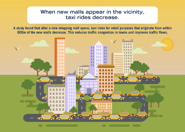
The objective of his study was to investigate how major retail amenities can reduce cross-township travel. Analysing data from the Household Travel Survey and taxi data, his study tracked and modelled the number of taxi trips to retail destinations, comparing it before and after the construction of new malls. The study sought to confirm that the township-centric urban planning philosophy in Singapore, where citizens’ daily needs are satisfied by amenities around their residences, would lead to less demands in cross-township travel.
Using the construction of new malls as natural experiment treatments, Prof Cheng and his co-author discovered that after a neighbourhood mall opens, individuals residing within 800 m from the mall reduce their taxi trips to other retail destinations by 18.5% during evening peak hours (after 5pm). This reduction brought the total travelled distance of residents down by 21%, suggesting that newly constructed malls indeed significantly reduce retail-related trips in the neighbourhood. Interestingly, during non-peak hours and weekends, the reductions in taxi trips were much lower (only 3.4% and 2.6% respectively), indicating that consumption habits are less likely to change when people have more time for leisure activities and when there is less traffic congestion.
Examining results more carefully, Prof Cheng and his co-author also discovered that residents living further away from the city centre and in the private housing estates are more likely to reduce taxi trips after the construction of neighbourhood malls. These results suggest that the role of expanded retail amenities to taxi-trip behaviours for retail is more significant if these amenities are provided in suburban locations and near residential areas that now have existing retail establishments close by.
Creating fair, lived access for residents
Assoc Prof Cheng is currently studying various transportation-related issues in cities; for example, the fairness in access to transportation services and the welfare impacts of the use of ride-hailing services. In particular, he is interested in quantifying the accessibility to both public and private transportation services across different regions in Singapore. He is also interested in quantifying how the use of ride-hailing services would affect the welfare of the general public, the drivers, and the passengers.
Data as a tool for planning
True outcomes of a city's blueprint can only be measured after it is built. Having realistic simulations that can predict the likely urban planning outcomes in aspects such as energy flows, transport flows, and the attractiveness of a city to residents has been valuable for urban planners. Creating more accurate and useful simulations uses data to further urban planning technology.
On the advantages of such urban simulations, Assoc Prof Cheng shares, “What I provide is a set of tools, using numbers to quantify the pros and cons of a particular design. Traditional urban planners do not go down to this level of detail as they would have to do manual iterations of city designs.” Assoc Prof Cheng explains that, “Computing technology extracts insights from existing data, allowing us to extrapolate and help the urban planner to play out more scenarios.”
He notes that there is no such thing as an “optimal” city design. “It is always about trade-offs,” he elaborates. “Planners will have certain priorities, such as increasing wellness or decreasing traffic. With a tool using simulations based on historical data, we could generate city-wide, reliable simulations that the planners can use to tweak and adjust their designs that align with their priorities,” Assoc Prof Cheng clarifies.
To conclude, he says, “Adopting big data and powerful AI tools allows urban planners to discover how their design choices would impact citizen’s welfare. With these concretely established insights, urban planners could more accurately estimate the pros and cons of their plans.”
Methodology & References
- Housing Development Board. (2024, January 18). HDB Town planning. Town Planning. https://www.hdb.gov.sg/about-us/history/town-planning
- Lee. K. O. & Cheng, S. (2023). Neighborhood retail amenities and taxi trip behavior: A natural experiment in Singapore. Habitat International. 131, 1-13. Available at: https://ink.library.smu.edu.sg/sis_research/7620
- Land Transport Authority (2023, October 27). Household Travel Survey (HTS). Land Transport Authority (LTA). https://www.lta.gov.sg/content/ltagov/en/who_we_are/our_work/lta_surveys.html
- Mueller, C., Klein, U., & Hof, A. (2018). An easy-to-use spatial simulation for urban planning in smaller municipalities. Computers, Environment and Urban Systems, 71, 109-119
- Robinson, D., Haldi, F., Leroux, P., Perez, D., Rasheed, A., & Wilke, U. (2009). CitySim: Comprehensive micro-simulation of resource flows for sustainable urban planning. In Proceedings of the Eleventh International IBPSA Conference (pp. 1083-1090).